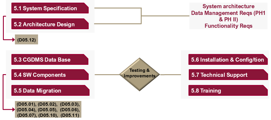
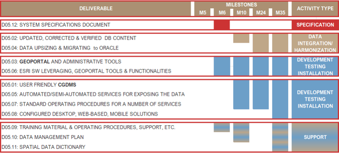
Qatar Geological Mapping Project - Phase II Task 5 – DATA INTERFACE ELEMENTS Objectives The design and implementation of a, scalable Central Comprehensive Geoscience Data Management System that will: Facilitate everyday work of the Ministry staff (various hierarchical levels). Create an appropriate interface with external stakeholders. Expose relevant data to the QGMP PH II Geoportal. The integration of data and digital products collected in the current project (QGMP) phase (II), as well as in Phase I. The establishment of standard data management functionalities. The development of software tools to allow a number of functionalities (i.e., save, edit, analysis and reporting, etc.). Task Implementation Activities Milestones Achievements & Current Status All relative deliverables and milestones were duly accomplishedData Base & System Design/ImplementationExisting geological data integrationData exposure to the QGMP PH II GeoportalProject Geoportal and relative functionalities The second project semester is very important as The 2nd version of the Geoportal exposing Remote Sensing data & products and relative functionality will be integrated (11/24) Data Base enhancements will be implemented Installation of the SW & HW of the CGDMS will be finalized