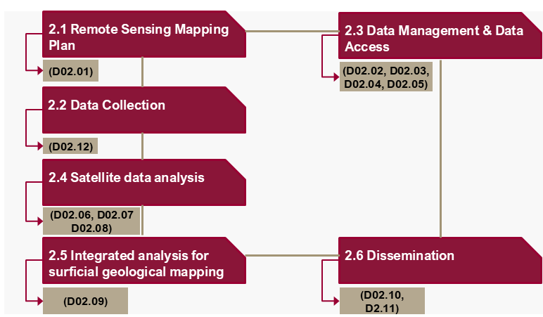
The development and implementation of a Remote Sensing plan to acquire and process multi-modal satellite data for producing the surficial geological map of Qatar at various scales.
Remote sensing derived information layers are complemented with in-situ data through ground-field inspections.
The establishment of standard data management functionalities.
Estimation of ground deformation regime in the full extent of the State of Qatar, by implementing PSI in SAR SLC images, also verified by ground-field inspections.
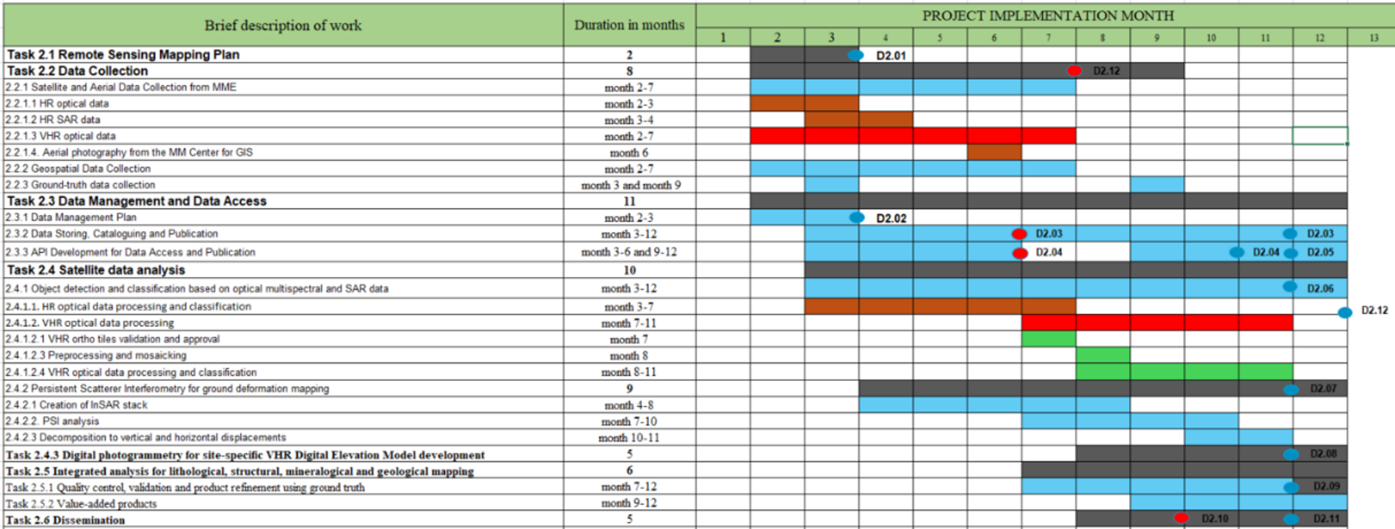
Task Implementation Activities
Milestones
Achievements & Current Status
All relative deliverables and milestones were duly accomplished
Remote Sensing Mapping Plan
Data Management Plan
Ground Survey
Several deliverables and milestones were anticipated