Qatar Geological Mapping Project - Phase II
Task 3 - GEOLOGICAL MAPPING PROGRAM
Geological mapping of Qatar in various scales (1/100000, 1/50000 and 1/20000)
Sedimentology, stratigraphy, structural geology, palaeontology, karstology and mineral resources studies for Qatar
Palaeoenvironmental and palaleogeographic reconstructions for Qatar
Approximation on urban hazard risk assessment

Geological mapping of Qatar in various scales (1/100000, 1/50000 and 1/20000)
During the geological mapping, walk-over surveys will be performed, and exposures, outcrops and landforms will be investigated in detail. It contains identification of rock units, their boundaries, ages, measuring of their stratigraphic sections and structural components. At the end of the surveys, the 1/100000, 1/50000 and 1/20000 scales of geological maps will be prepared.
Strategy of the data collection will be executed in three ways: Field studies, laboratory and computer based studies, and correlation of data with subsurface findings.
Sedimentology, stratigraphy, structural geology, palaeontology, karstology and mineral resources studies for Qatar
During the geological mapping;
stratigraphy (outcrop and measured stratigraphic sections), sedimentology (facies interpretations and paleoenvironmental analysis),
structural geology (structural and kinematic analyses),
paleontology (macro and micro fossil descriptions),
karstology (karstological investigations),
coastal geology (nearshore and coastal zone investigation),
mineral resources assessment (searching potential of construction raw mineral resources), and
sampling will be applied.


Palaeoenvironmental and palaleogeographic reconstructions for Qatar
To determine and interpret the paleoenvironments and paleogeography of the geological formations, measured stratigraphic sections will be taken from the appropriate places of the sequences.
On the measured stratigraphic sections, petrographic and paleontological data determined will be also added, facies associations will be distinguished, and the depositional environments and sub-environments will be interpreted. By revealing the stratigraphic relationships and their correlations, paleogeographic and paleoenvironmental reconstructions for Qatar will be prepared.
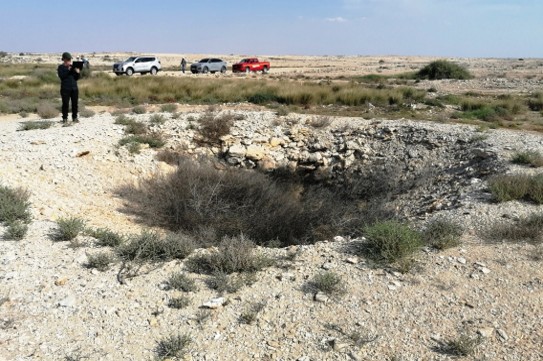
Approximation on urban hazard risk assessment
To support critical urban and infrastructure planning functions for Qatar, it is critical to identify and mitigate karstic, hydrologic and tectonic hazards.
By adding karstic, hydrologic and tectonic features to GIS environment, such spatial information can be used with the prepared geological maps to create a comprehensive maps of sinkholes, and underground karst formations. They can present hazard for constructions, especially with load-bearing capacity of the rocks. Additionally, the hazard assessment of tectonic structures relies on understand the geological history. All such features of Qatar can be a potential hazard for geotechnical engineering, land-use planning, construction, and groundwater contamination.